

MUDDY CREEK PROJECTS
SRWG’s roots are in Muddy Creek: our organization stemmed from the Muddy Creek Task Force, a grass-roots movement to improve water quality in Muddy Creek. Projects and studies have been performed on Muddy Creek since the 1990s. The projects featured below are currently in progress, but in time we will be adding information about more historic projects and their impacts. For Muddy Creek reports and assessments, visit our RESOURCES page. You can learn more about water quality data collected from Muddy Creek and across the watershed HERE.
SRWG was awarded $1.7M for restoration projects at Muddy Creek.
Read the PRESS RELEASE to learn more.
View the Muddy Creek Master Plan for more details about future work.
MUDDY CREEK MASTER PLAN
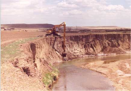
SRWG recently completed a two-year effort to develop a Master Plan for Muddy Creek. The plan was developed by an engineering team that included Restoration Engineering, Applied Geomorphology, DTM Engineering, and Troutwater Consulting. The team worked with local stakeholders to document the problems contributing to erosion and poor water quality in Muddy Creek and to develop a suite of actions to address those problems. The final plan includes a description of the complex issues affecting Muddy Creek, the history of work completed in the past, and a prioritized list of projects and actions to continue improving conditions on the creek. These include large-scale infrastructure projects on Greenfields Irrigation District to improve water management, stream bank and in-channel treatments to restore natural processes and mitigate erosion, and Best Management Practices stream-side landowners can employ to do their part to reduce impacts of living on the banks. This Master Plan was funded by a Bureau of Reclamation WaterSmart Cooperative Watershed Management Program Phase I Grant awarded to SRWG in 2020. You can download the plan on our RESOURCES page.
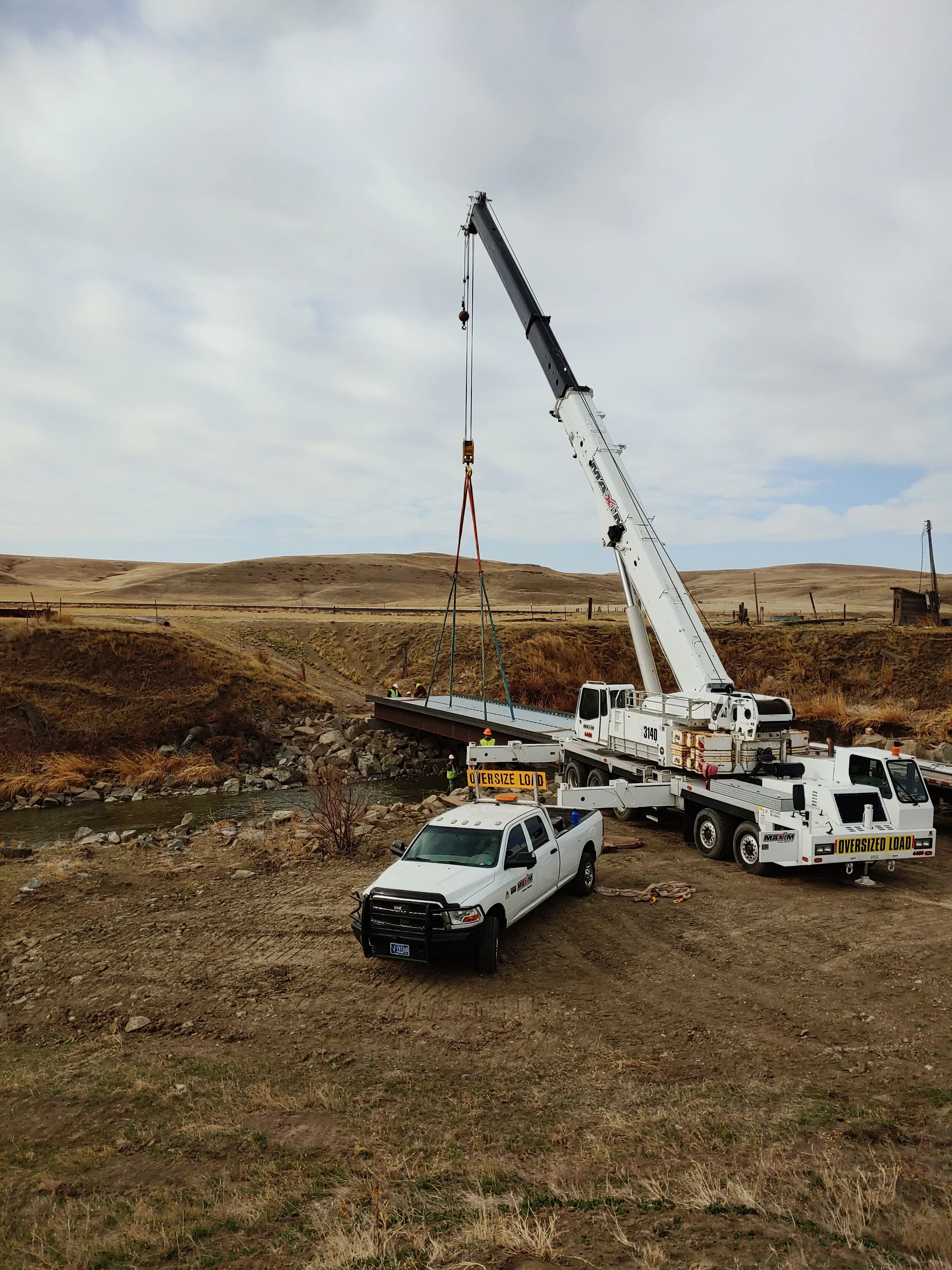
MUDDY CREEK CROSSING
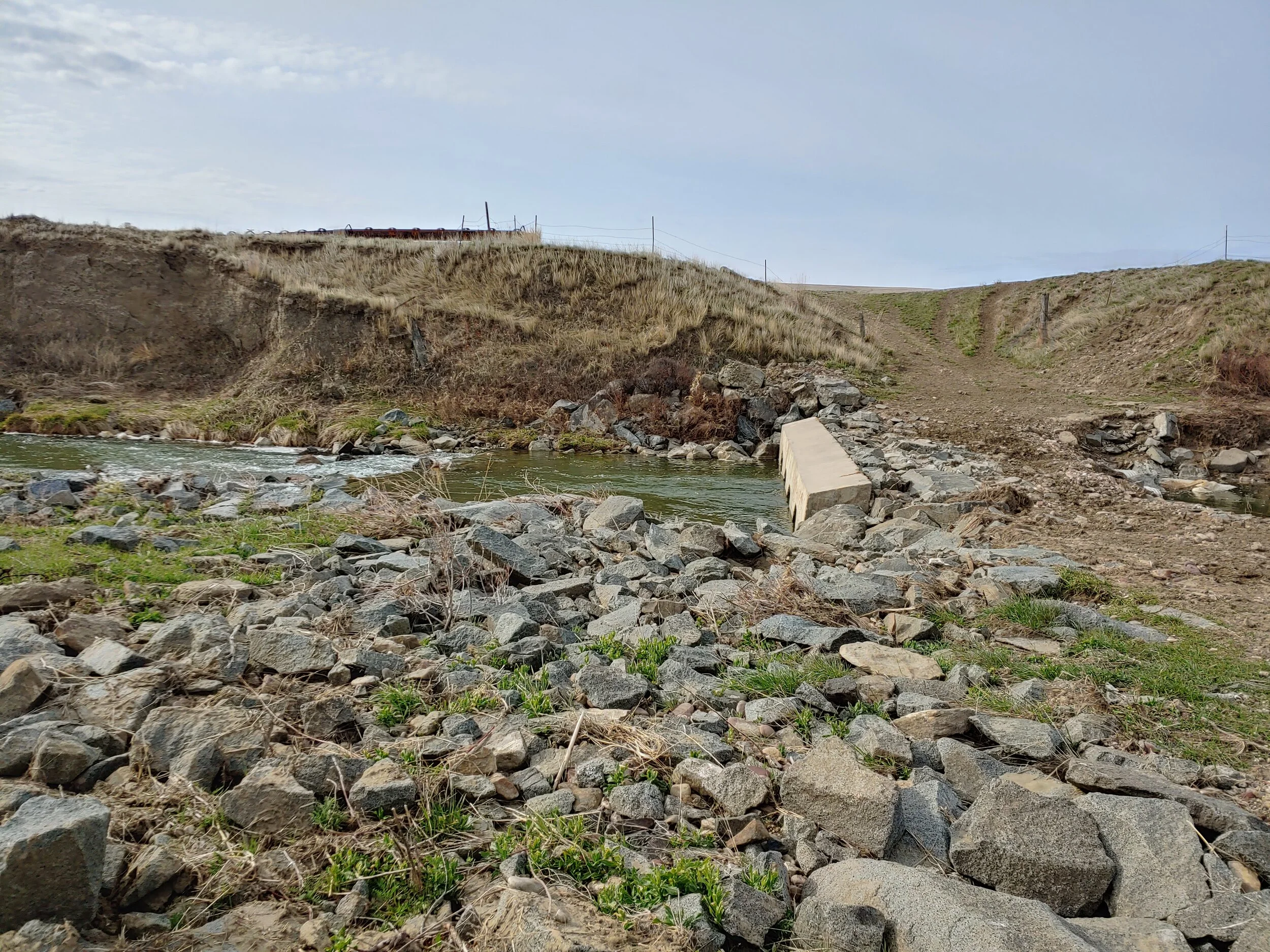
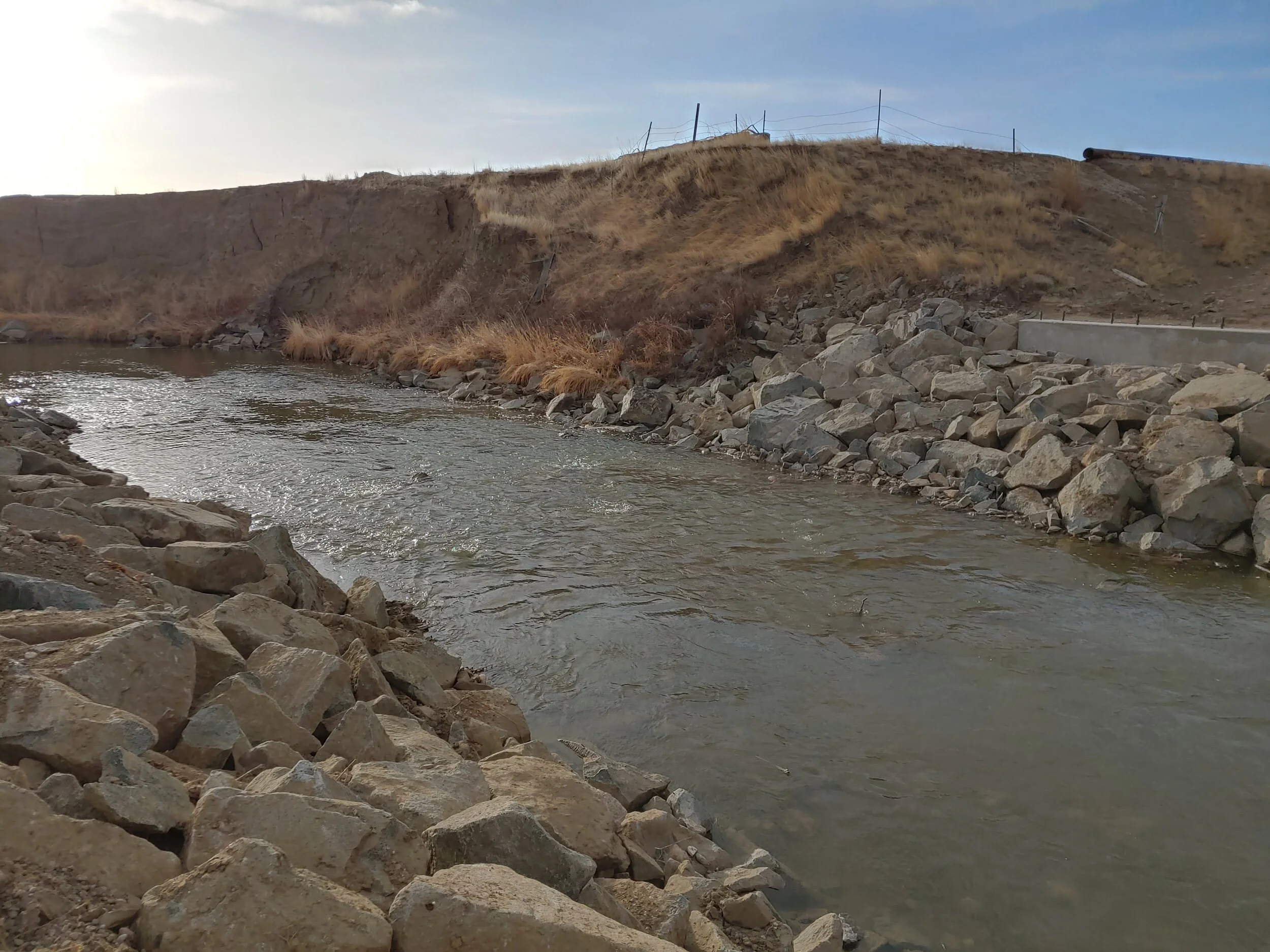
The Muddy Creek Crossing and Habitat Project includes the replacement of an aging culvert crossing with a new bridge, new livestock fencing, and vegetation enhancements. The new bridge will provide for stream crossing with less impacts on the stream, which will reduce erosion, improve fish passage and habitat, and create a more natural stream flow. New vegetation will help stabilize stream banks, filter nutrients from entering the creek, and provide stream shade and other habitat features. Fencing will be installed to exclude livestock from the stream banks. This will allow vegeation to grow, reduce bank damage from trampling, and reduce animal waste from washing into the creek. This project was made possible by funding from Montana Department of Enviornmental Quality, Montana Watershed Coordination Council, Missouri River Flyfishers, Montana Trout Unlimited, Greenfields Irrigation District, and a private contribution. Construction was performed by Greenfields Irrigation District; Morrison-Maierle provided engineering services.


MUDDY CREEK STREAM GAGES
With support from Greenfields Irrigation District and volunteers, SRWG recently installed a new stream gage on upper Muddy Creek, just downstream from the town of Power. This gage replaces the old gage, previously located upstream, which was washed away in 2018 flooding.
SRWG maintains several seasonal stream gages, which operate from approximately May - September to coincide with the irrigation season. Data from these gages can be accessed on the DNRC StAGE site. There is also a USGS stream gage on lower Muddy Creek near the town of Vaughn. That gage information can be accessed here.
More information about the Sun River watershed stream gage network and water management can be found here. Or, you can view a full range of watershed data, including water quality data, on our River Conditions page.